
Sources for Everett Neighbors
The most reliable block search separates land, people, and community evidence. SCOPI shows parcel polygons around an Everett address. The Assessor adds owner, taxpayer, situs, and mailing fields. City neighborhood pages describe the local association and map label, while historical directories can place earlier occupants by street number. Voter material is restricted and is not an open block roster.
| Source | What It Shows About a Block | Access |
|---|---|---|
| SCOPI | Adjacent parcel shapes, addresses, owners, taxpayers, values and tax codes | Free public map; click each polygon |
| Assessor Property Search | Owner and taxpayer with separate situs and mailing addresses | Free portal and office assistance |
| VoteWA and voter extract | Registration or precinct fields where law permits | Personal portal or approved request; protected data withheld |
| City neighborhood page | Official map label, association and leader contact path | Public page; no member directory found |
| Polk and Sanborn collections | Past occupants, street numbers, buildings and lot context | Everett Public Library and local-history access |
An Assessor result proves who the county lists in the account role, not who sleeps at the address. The mailing field records where tax mail goes. It can differ from the situs address, which is the parcel's physical location. Preserve both. A matching mailing and situs address may support an owner-occupancy hypothesis, but it still does not identify other adults, children, guests, or renters.
Click Everett's Bordering Parcels
Snohomish County's SCOPI map has no verified buffer or automatic radius export. The accurate method is manual. Search or pan to the target, click its parcel polygon, and record Parcel ID, Property Address, and Owner. Additional details may show taxpayer, acreage, market value, and tax code area. Open the Property Account Summary when transfer history, legal description, taxes, or building details matter.
Then click every polygon that touches the target parcel and the lots across the street. A map tip that says “Multiple Parcels” needs another click. Blank tips may be Shared Interest Parcels or areas that are not legal tax parcels, not missing people. The map also offers aerial imagery, appraisal neighborhoods, and recent-sale layers. Recent sales exclude some multi-parcel, quitclaim, estate, and gift transfers, so absence from that layer is not proof that title never changed.
Keep two address fields. A taxpayer's mailing address and the Everett parcel's situs address serve different record purposes.
Map an Everett Block
Use a fixed path so the block notes remain tied to the map. The process stays on the immediate ring of lots. For the complete chain along a named road, use the Everett street directory workflow instead.
- Locate the address in SCOPI and verify its house label, parcel outline, and Parcel ID.
- Click each bordering lot and the lots directly across the road. Record owner and taxpayer as separate roles.
- Open each Assessor account. Compare situs and mailing addresses, account year, and any transfer clue.
- Add city neighborhood, permit, or historical context only after the parcels are stable. Date every note.
This creates a parcel-based block inventory, not a list of all nearby residents. Parcel boundaries can cross what looks like one yard, and a condominium or shared-interest area may have several linked accounts. For a geometry problem, the Assessor GIS division accepts map questions at assessorgis@snoco.org and by phone at 425-388-3358.
Everett Neighborhood Contacts
The City of Everett Neighborhoods page maintains the official association list, map, Neighborhood Leaders Roster, council-district links, and notification path. Groups often meet in person or online. These contacts help place a block within a civic area, locate public meetings, and ask about community history. The city does not publish member addresses, a citywide HOA directory, or a block-watch roster.
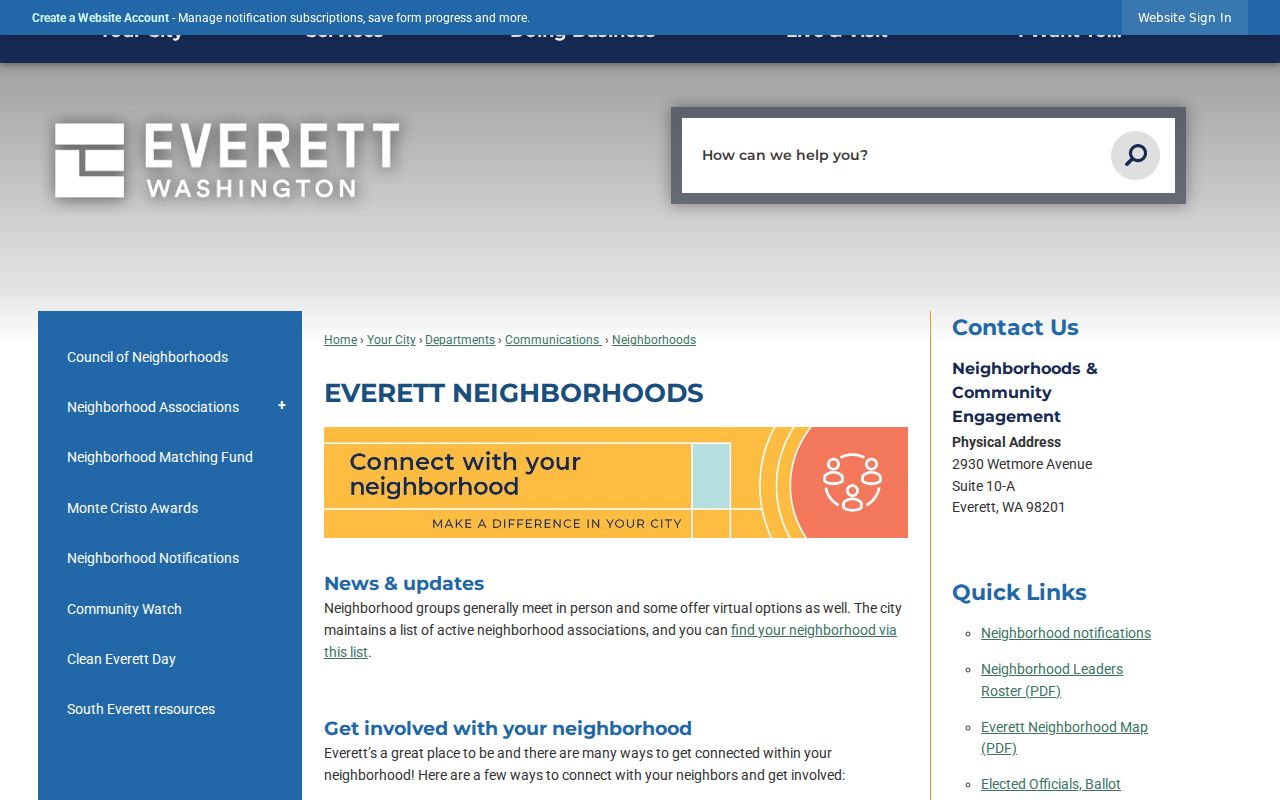
The captured city page leads to neighborhood resources rather than a private household list. Contact Lisa Syravong at 425-257-8695 or 2930 Wetmore Avenue, Suite 10-A, for the city's neighborhood program.
Waterfront and central
Bayside, Northwest, Port Gardner, Riverside, and Delta provide useful local map terms.
South and west
Boulevard Bluffs, Harborview–Seahurst–Glenhaven, View Ridge–Madison, South Forest Park, and Westmont.
East and southeast
Silver Lake, Twin Creeks, Valley View, Cascade View, Pinehurst–Beverly Park, and Glacier View.
Everett Labels Are Geography
Everett's 21 official neighborhood names organize city outreach and map context. They do not prove association membership or identify your neighbors. Industrial and Smith Island labels may cover land with little residential use. Combined names such as Harborview–Seahurst–Glenhaven and Pinehurst–Beverly Park can be more precise search terms than an informal name used in conversation.
City limits can also change around a long-lived address. Everett has completed 88 annexations and, in 2026, is studying about 4,850 acres south of the present boundary with roughly 48,000 residents, including a Mariner area of about 1,250 acres and 21,000 residents. Any future annexation could change city services, council districts, municipal-court relevance, and the meaning of “Everett” in a database. Keep the record date and confirm the boundary map for that year.
Everett Voter Block Limits
Washington law does not provide an anonymous public roster of every voter on an Everett block. VoteWA is a personalized registration portal. The Secretary of State's database extract requires an application, review, and approved delivery. RCW 29A.08.720 restricts commercial use and misuse, while Address Confidentiality Program participants and other protected voters are withheld.
Precinct, council-district, and neighborhood maps show geography only. They do not reveal who voted, a ballot choice, or party preference. Washington does not register voters by party. Snohomish County Elections offers online, phone, mail, email, and in-person help for one's own registration, but does not publish an unrestricted street list. A missing voter result should never be filled by inference from household composition or map counts.
Trace Past Everett Neighbors
For an older block, Polk directories and Sanborn fire-insurance maps answer different questions. Everett Public Library's Polk run spans 1893 through 1999, with an address index beginning in 1932. An address-index entry can show a past occupant at a street number. Sanborn maps from 1892, 1893, 1902, 1904, and 1914, with updates through June 1955, show building footprints, lot context, and use rather than names.
Pair the directory year with the map sheet and keep old street text exactly as printed. The Northwest Room can also help with local maps, newspapers, yearbooks, cemetery material, and building research. Its renovation closure through fall 2026 makes email requests important. Early county permits were not retained and blueprints are not on file, so a gap in those records is not proof that a house or occupant was absent.
Everett Address Record Fallbacks
City permits and project files can add a builder, applicant, occupancy, utility, land-use, or remodel clue to a parcel timeline. Everett's eTRAKiT search redirects to a free public login, and the anonymous result field set was not verified. Use the Digital Records Center, the authenticated route, or a focused city request when the public search does not answer the address question.
Ask for a named address, record type, and date range. Under the Washington Public Records Act, an agency generally responds within five business days by producing the record, estimating a production date, asking for clarification, or giving the legal basis for denial. County parcel and deed records remain with county custodians. Historical directories and maps remain with the library or archives. Sending each request to the right keeper avoids a false “no records” response.
Compare Everett Neighbor Tools
Official and commercial tools often look similar but have different evidence behind them. A county parcel account states its source, role, and tax year. A city neighborhood page identifies civic geography. A commercial neighbor tool may blend old directories, marketing files, court indexes, and parcel data without showing when the pieces were updated. That can merge people with the same name or carry an old address forward.
| Source type | Best use | Main limit |
|---|---|---|
| Official parcel and city records | Current owner, taxpayer, boundary, and civic map context | Not a household roster |
| Library and archive sources | Past occupant and building context by year | Coverage gaps and in-person or staff access |
| Commercial category | Possible lead to verify elsewhere | Stale, merged, paid, or weakly sourced data |
Use the commercial category only as a lead, never as final proof. Return to the Assessor, GIS map, city source, library volume, or custodian file before attaching a name to an Everett block.
Privacy for Everett Neighbors
Public records do not expose every person at an address. Non-owner occupants, children, DMV files, utility accounts, delivery data, private association memberships, and protected voter addresses remain outside the ordinary roll. Washington's Address Confidentiality Program gives qualified survivors and other eligible people a substitute address, mail forwarding, and a service agent. Do not try to reverse that substitute through parcel, voter, or directory matching.
Even an open parcel record can be wrong or out of date. Check the account year and report a source error to its custodian. Use an association contact to learn about a public meeting or block project, not to demand a member list. Respect no-contact requests and avoid publishing a compiled household profile.
Lawful use. Research Everett neighbors for lawful civic, historical, or personal reasons. Never use records to watch, stalk, harass, threaten, or intimidate anyone.